






Mapwith.ai
Mapwith.ai: an intelligent tool focused on improving AI efficiency.
Tags:AI improves efficiencyWhat is Mapwith.ai?
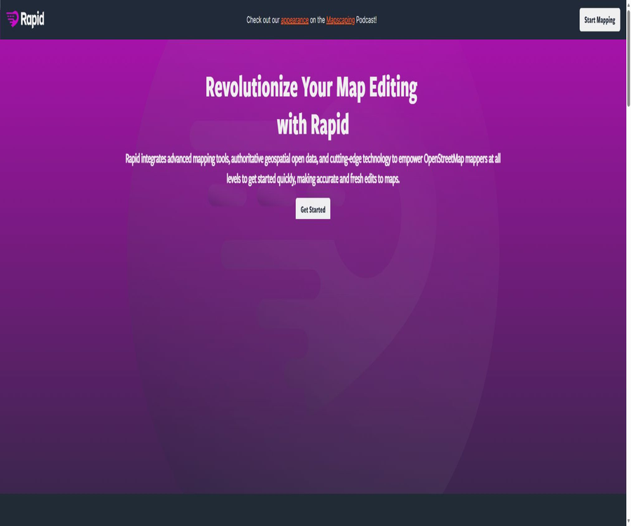
Mapwith.ai is an AI-powered mapping service developed by Meta for the open mapping community; the main tool used for editing and maintaining maps is called Rapid Editor. It is designed for editing OpenStreetMap data, allowing model-predicted elements such as roads and buildings, along with other open geographic data, to be added to maps. This helps mapmakers identify missing information and verify it item by item.
Rapid Editor is maintained by the open-source community, and its current stable version is 2.5.7. It is not an unreviewed tool that uses AI to make automatic changes to maps in bulk; the decision as to whether to adopt certain elements, how to adjust labels, and whether to upload something remains with the cartographer who is logged in.
The difference between name and composition
| Name | Positioning | Primary uses | Current status |
|---|---|---|---|
| Mapwith.ai | AI-assisted mapping services and established brands | Provide predictive map elements to the Open Maps community | The current editing interface has been switched to Rapid Editor. |
| Rapid Editor | Browser map editor | View, edit, verify, and submit changes to OpenStreetMap | Ongoing maintenance |
| Rapid SDK | Components for map processing and editing development | Available for developers to build editors, processors, and validation tools | Independent open-source projects |
Main functions
- Overlay of AI candidate elements: On the map, these elements—such as roads, buildings, or other potential features identified by the model from satellite images and other data—are displayed as separate layers. Users can add a single candidate element to the map they are editing, which is useful for completing road networks or building outlines that have not yet been drawn.
- Visual map editing: It allows for the creation and modification of points, lines, polygons and their labels, as well as the execution of common editing operations such as connecting, splitting, merging, and orthogonizing. The input consists of the current map objects, images, and human judgment, while the output is the set of changes to be submitted to OpenStreetMap.
- Data integrity check: Before saving, issues such as intersecting roads, unconnected nodes, excessively short roads, abnormal geometry, and other common problems are checked, and these problems are displayed according to their severity. Some errors prevent the upload from taking place; users must fix them or confirm them before submitting.
- Multi-layer assistance for judgment: It is possible to switch between background images, street view photos, open map data, historical images, and third-party task layers. Each layer is subject to its own coverage area, licensing restrictions, and availability of services; therefore, objects that appear in the images cannot be considered as facts that can be published outright.
- Unified data catalog: The map data panel enables searching for and activating Rapid, Esri, and other open datasets; users can select the available content based on their current location. Read-only datasets are used for comparison, while the candidate datasets that can be imported must still comply with the relevant licensing and labeling rules.
- MapRoulette task: It allows users to view map repair challenges within the editor, filter tasks, and record their status as repaired, incomplete, resolved, or not a problem. Once editing is completed and saved, the relevant task information is added to the change set, making it suitable for community quality control projects.
- Custom data and tracks: It is possible to load auxiliary content such as GPX tracks, GeoJSON, or WKT geometries using startup parameters; it is also possible to select predefined datasets, map locations, objects, and languages. Custom content is used primarily for positioning and reference, and whether it can be included in open maps depends on related rights and editing rules.
- Localization and quick operations: The interface supports multiple languages, a right-to-left layout, keyboard shortcuts, map rotation, and layer switching. New users can first complete the built-in operation guide before proceeding to edit actual areas.
Input and output
| Type | Acceptable content | Handling method | Generate results |
|---|---|---|---|
| Online map data | OpenStreetMap nodes, roads, areas, relations, and tags | Modify the geometry or properties after selecting the object. | Map change set to be uploaded |
| AI and open datasets | Predict geographic elements in roads, buildings, and catalogs | Check each item individually, apply, connect, and add labels. | Map objects verified manually |
| Background and street scenes | Satellite images, historical images, and street view photos | Used for positioning, calibration, and cross-verification | It will not be uploaded as a map object directly. |
| Custom files or parameters | GPX, GeoJSON, WKT, object IDs, and task parameters | As a covering layer, positioning condition, or editing configuration | Auxiliary layers or pre-configured editing sessions |
| Local backup | Current editing session | Save the modifications as a local change file. | Editable data that can be restored or rechecked |
Usage tutorial
- Open Rapid Editor and first browse the target area; you can view the map, background images, and available datasets without needing to register.
- To submit changes, log in to your existing OpenStreetMap account; meanwhile, familiarize yourself with the community’s editing guidelines, object tagging rules, and requirements for change sets.
- In the map data panel, enable the Rapid data or other datasets suitable for the current area, and check the data description, coverage area, and licensing terms.
- Zoom in to a readable scale and select a potential road or building; then use existing maps, images, trajectories, and street views to verify whether it actually exists.
- After adopting the candidate elements, adjust the node connections, outlines, and labels; do not treat the predicted road type, name, or traffic attributes as confirmed information.
- Run a problem check to address broken roads, incorrect intersection types, duplicate objects, overly short segments, and abnormal labels; undo any uncertain edits if necessary.
- Fill in a clear description of the change set and the datasets used, preview the content that is about to be submitted, and then upload it to OpenStreetMap.
- After submission, check the change set and community feedback; if errors are found, they should be corrected or reverted promptly, and project management requirements must be followed in large-scale tasks.
Key points when evaluating AI pathways
- Each AI path requires manual selection and verification; regular editing sessions do not allow for the bulk uploading of prediction layers as a whole.
- Predictions may suffer from missed or incorrect detections due to clouds, trees, buildings, differences in imaging time and location; therefore, manual intervention is still required to fill in the missing parts.
- Predicting road classification and labels is more difficult than geometric recognition; it is necessary to adjust attributes such as road grade, surface type, traffic conditions, and names in accordance with regional rules.
- Clipping or disconnected segments may appear near the boundaries of tasks; it is necessary to check the connection between adjacent tasks and existing roads before saving.
Costs and entry requirements
| Package or version | Price | Billing cycle | Core benefits or quota | Suitable for users |
|---|---|---|---|---|
| Rapid Editor online service | 0 dollars | No subscription required | Browse maps and use the editor; submitting changes requires an OpenStreetMap account, and AI data is subject to regional coverage and session limits. | Open map makers, volunteers, and community projects |
| Rapid Editor source code | 0 dollars | No subscription required | It can be used, copied, modified, and distributed under the ISC license; deploying it on one’s own entails the costs associated with development and operation. | Map platform developers and research teams |
| Rapid SDK | 0 dollars | No subscription required | Provides geometric mathematics, map processing, and general toolkits, under the ISC license. | Developers who create map editors, processors, or validators |
The online service is currently free of charge; there are no personal, professional, or enterprise subscriptions, nor is there any system for purchasing credits. The terms of service grant the provider the right to modify, suspend, or terminate the service, so the fact that it is free does not mean it will always be available or that certain service standards will be guaranteed.
Which users are it suitable for
- OpenStreetMap editors who wish to add roads, buildings, and public facilities.
- Volunteer teams involved in disaster response, connectivity in remote areas, and community mapping projects.
- The person in charge of carrying out quality inspection tasks for MapRoulette, cleaning up map data, and coordinating the review of batch projects.
- Mapmakers who need to combine open geographic data, historical images, and street views in a single interface for cross-referencing.
- Developers who intend to create custom editors or spatial data processing tools based on open-source mapping components.
Advantages
- By combining AI-based elements with established manual editing processes, the mechanical work of creating content from blank images can be reduced.
- The model results are not written directly to open maps by default; instead, manual verification is carried out for each item before it is saved, as part of the quality control process.
- It supports various types of open datasets, street views, historical images, task platforms, and custom layers, making it suitable for complex map verification tasks.
- Both the editor and the development components have their code made available publicly, under permissive licenses; teams can audit the implementation, contribute fixes, or create custom deployments.
- The update logs remain publicly available; versions 2.5.6 and 2.5.7 include fixes to address cross-site scripting issues.
Capabilities boundaries and limitations
- The coverage of AI is not uniform across the world; to determine whether roads, buildings, or other relevant data are available in a particular area, it is necessary to check the data catalog in the editor.
- Predictive elements may be missing, offset, misclassified, or inconsistent with older images; they cannot replace local knowledge, on-site investigations, and manual verification.
- Third-party images, street views, and datasets come with their own licensing terms, privacy policies, geographical restrictions, and risks of service disruption; Rapid’s open-source license does not cover these aspects automatically.
- Submitting online relies on an OpenStreetMap account and its interfaces; account permissions, community bans, or network issues can all affect the saving process.
- Rendering in complex areas relies on the browser’s graphics capabilities; low-performance devices, ad blockers, or privacy settings that prevent third-party requests can cause issues with the layers.
- The pre-release Canary version is intended for testing purposes; it may be unstable and therefore not suitable as the sole environment for critical mapping tasks.
Supported platforms
| Platform | Support methods | Key capabilities | Precautions |
|---|---|---|---|
| Desktop browser | Native web applications | Complete map editing, layer management, validation, and submission workflow | It is recommended to use a modern browser that is well-maintained and to enable the necessary storage. |
| Browser on mobile phone or tablet | Mobile web page | Supports touch zoom and some interactions for small screens. | Complex editing, label filling, and multi-layer verification are more suitable for large-screen devices. |
| Self-hosted web pages | Built on open-source code | Replace images, data, and runtime configurations to create a deployment that is not based on OpenStreetMap. | It is necessary to develop, deploy, and review third-party data licenses on one’s own. |
| Native apps and browser extensions | Not confirmed yet | No official native clients or extensions for Windows, macOS, iOS, or Android were found. | Do not consider mobile web pages to be native applications. |
API, SDK, and open-source status
The full editor code of Rapid Editor is licensed under the ISC license, which permits its use, copying, modification, and distribution as long as the copyright and license notices are retained. The code is provided as is, without any warranties regarding its marketability, suitability for a particular purpose, or error-free operation.
- The editor project includes integration examples, development documentation, contribution guidelines, issue tracking, and a complete update log.
- The existing API documentation primarily describes the startup parameters, the replaceable runtime objects, and the options for customized deployment; it serves as a description of the integration interface, rather than a commercial cloud API that includes keys, usage metrics, and service levels.
- The Rapid SDK is an independent open-source project that provides modular code for tasks such as map editing, data processing, geometric calculations, coordinate transformation, as well as handling of ranges and slices.
- The predictive data provided by Mapwith.ai and the code in the editor are subject to different licensing terms; the terms of service state that the service data is licensed under the MIT license, with the requirement to retain copyright information, identifiers, and any necessary attribution details.
- The existing data on OpenStreetMap, as well as the content submitted by users, are subject to the open database licenses and community rules; it is not possible to determine all commercial usage requirements solely based on the ISC or MIT licenses.
Developer onboarding process
- First, decide whether to embed a full editor, use the Rapid SDK, or simply set the map location and layers via startup parameters.
- Check the licenses for the editor, SDK, map data, imagery, and third-party services separately, without combining different licenses into one concept.
- Create containers and contexts following the example, and configure the background image, data directory, authentication settings, and storage destination; in environments that are not based on open maps, the corresponding runtime objects need to be replaced.
- Verify coordinates, geometric editing, error checking, authentication, and data writing in a testing environment, and then assess performance, security updates, and long-term maintenance responsibilities.
Notes on privacy, security, and copyright
- Rapid uses cookies, website logs, and similar technologies to maintain login sessions, track the use of various functions, diagnose problems, and improve the editor; disabling cookies may result in loss of access to the login account or to some of the functions.
- To submit map modifications, it is necessary to log in to OpenStreetMap; the authentication method and the public change sets are also subject to the privacy rules of the respective platform.
- Rapid will automatically add tags such as the editor’s identifier and status indicating experience or level of guidance to the submitted change set; the change set itself is part of the history of the public map.
- When background images, street views, brand suggestions, or external quality inspection services are enabled, the browser will directly request content from third parties; if you do not want to interact with a particular third-party service, you should disable the corresponding layer or privacy setting.
- Public map editing is not suitable for entering details of personal addresses, private access information, or data that cannot be made publicly available legally; before submitting such information, it is necessary to verify its accuracy, assess the privacy risks involved, and comply with community guidelines.
- The website’s terms state that the service is provided free of charge as it is, and it can be changed or discontinued at any time; users should keep local backups of any important edits, and they bear the risks associated with making changes, deploying the service, and using the data.
Summary
The core value of Mapwith.ai and Rapid Editor lies in transforming AI predictions and open geographic data into draft map edits that can be reviewed manually, rather than generating a final map that requires no verification. They are suitable for contributing to open maps, carrying out community tasks, and developing custom maps; however, users must deal with issues such as model errors, data licensing, third-party privacy concerns, and the responsibilities associated with public change sets.
Tools similar to Mapwith.ai



 Guigong Network Security Registration No. 45132202000164